Same Street, Different City: How Weather Rewrites the Urban Experience One Block at a Time
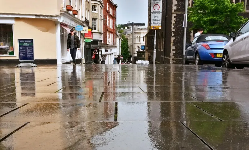
There's a stretch of road in almost every American city that you've walked a hundred times. You know where the sidewalk buckles near the coffee shop, which corner gets loud around noon, and exactly how long the light takes at the main intersection. You think you know that street.
Then it rains.
Suddenly the whole thing is different — the smells sharper, the sounds bouncing off wet pavement in ways they never do on a dry afternoon, the usual foot traffic thinned out or rerouted entirely. You're walking something familiar and foreign at the same time. That's not a glitch in your perception. That's the city showing you a version of itself you hadn't met yet.
Weather isn't just backdrop. For walkers, it's a full sensory filter that rewrites the urban landscape in real time. And once you start paying attention to what each condition actually does to a route, you stop seeing weather as something to walk through — and start seeing it as something to walk with.
What Rain Actually Does to a City
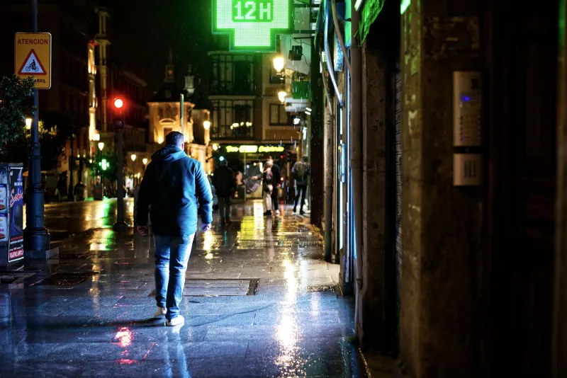
Rain is the most dramatic urban transformer, and not just because it's wet. The moment precipitation hits pavement, the entire acoustic environment shifts. Sound travels differently on wet surfaces — footsteps sharpen, traffic gets a low, hissing undertone, and conversations across the street carry further than they should. Cities that feel noisy and chaotic on a dry Tuesday afternoon can take on an almost cinematic quality in the rain.
Then there's the smell. That petrichor hit when rain first meets warm asphalt isn't just pleasant — it's informationally dense. In older neighborhoods, rain pulls decades of accumulated urban residue to the surface. You'll catch diesel, old concrete, cut grass from a nearby park, the metallic tang of a storm drain. In newer developments, the smell is flatter, almost synthetic. Rain essentially gives you an olfactory map of a neighborhood's age and density.
Foot traffic patterns shift too. Covered routes — arcades, awnings, parking garage overhangs — suddenly become the preferred paths, and you start noticing architectural features you'd never registered before. That ornate overhang above the old bank building downtown? On a sunny day it's invisible. In a downpour, it's infrastructure. Rain is a great equalizer that way: it exposes which parts of a city were actually designed for human beings and which parts were designed for cars.
The Fog Walk: When Familiar Routes Become Explorations
Fog does something psychologically interesting to urban walkers. It compresses the world. A street that normally reads as a long corridor with a clear vanishing point suddenly ends about half a block ahead. Your sense of scale collapses, and with it, your sense of certainty about where you are.
This sounds disorienting, but experienced walkers will tell you it's actually one of the best conditions for rediscovering a neighborhood you think you know cold. When you can't see the landmark at the end of the road, you start paying attention to what's immediately around you — the texture of a building's facade, the particular font on a shop sign, the sound of a train two blocks over. Fog forces presence.
In coastal cities like San Francisco, Seattle, or Boston, fog is practically a seasonal personality. The way it pools in valleys, clings to bridges, and burns off block by block through the morning is a kind of urban choreography. If you've only ever walked those cities in clear weather, you've missed half the show.
Heat and the Slow City
Extreme heat fundamentally changes the pace and texture of urban walking in ways that are easy to underestimate until you're actually out in it. In the American South and Southwest especially, summer heat doesn't just make walking uncomfortable — it restructures the entire social geography of the street.
Shade becomes the most valuable real estate in any neighborhood. You'll find yourself navigating not by landmarks but by tree canopy, building overhangs, and the north sides of east-west streets. Heat-mapping a neighborhood on foot is one of the most revealing things you can do: the blocks where people are still sitting outside, where kids are still playing, where foot traffic hasn't collapsed — those are the blocks with mature trees, good awnings, and buildings that were designed before air conditioning made outdoor comfort optional.
There's also a social dimension. Cities slow down in heat, and the people who remain visible on the street tend to be those without the option of retreating indoors. Walking a neighborhood in a July heat wave in Phoenix or New Orleans tells you something about economic geography that a comfortable spring afternoon will not.
Snow: The City Stripped Down
Fresh snow is the closest thing to a blank canvas a city ever gets. For about forty-five minutes after a significant snowfall, before the plows and the foot traffic and the exhaust fumes turn everything gray, you get the city in a kind of pure state. Familiar routes look architectural again — you notice rooflines, cornices, and the geometry of intersections in ways that the visual noise of daily life usually obscures.
But snow walking is also deeply revealing in a different way. Once people start moving, the paths they choose tell you everything about how a neighborhood actually functions versus how it was planned. Desire lines — those unofficial shortcuts that pedestrians wear into grass or gravel — show up in snow as unmistakable tracks cutting across corners, through parking lots, between buildings. You can see in real time how people actually want to move through a space.
Snow also exposes maintenance inequities with brutal clarity. Some blocks get shoveled within an hour. Others stay icy for days. The pattern almost never surprises you if you already know the neighborhood's demographics, but seeing it rendered in salt and cleared concrete versus packed ice makes it viscerally undeniable.
Walking the Same Route Four Times
If you want to understand a neighborhood — really understand it, past the surface layer of what's there — try walking the same route in four different weather conditions. Same starting point, same ending point, same time of day if you can manage it. Take notes, or just pay attention.
What you'll find is that you're not walking the same place four times. You're walking four different cities that happen to share the same address. The rain version, the fog version, the heat version, the snow version — each one reveals something the others hide.
That's the thing about weather that most travel content ignores. It's not an obstacle to experiencing a city. It's one of the most powerful lenses for experiencing it accurately. The version of a city you get on a perfect 72-degree afternoon with low humidity and golden-hour light is real, sure. But it's the edited version. The highlight reel.
The rain version? That's the director's cut.