Down the Back Way: What Alleys, Underpasses, and Dead Ends Tell You About a City's Soul
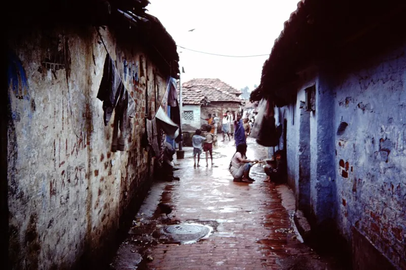
Photo: Pál Baross, CC BY-SA 3.0, via Wikimedia Commons
Every city has a front door and a back door. Most visitors—and honestly, most residents—only ever use the front. The wide boulevards, the renovated waterfronts, the Instagram corners with the good light. But the back door? That's where the city actually lives.
Alleys. Underpasses. Streets that just... stop. These are the spaces urban planners and tourism boards quietly skip over, and that's exactly why you should be walking straight toward them.
Why the Forgotten Routes Matter
There's a reason cities feel generic now. Redevelopment cycles have a habit of sanding down the rough edges, replacing century-old brickwork with glass condos and turning industrial corridors into "innovation districts" with artisanal coffee at every corner. But the infrastructure that predates all of that—the alleys dug before cars existed, the underpasses built during the postwar highway boom, the dead-end streets that once served factories now long gone—those spaces are harder to erase. They're load-bearing, literally and historically.
When you walk them deliberately, you start reading a city the way an archaeologist reads a dig site. Each layer tells you something different.
Pittsburgh: The Alley Networks That Predate the Grid
Pittsburgh is one of the best American cities for alley walking, and most people have no idea. The city's topography—all those hills and river valleys—meant that its 19th-century planners couldn't impose a clean grid the way Chicago or Philadelphia managed. What grew instead was a chaotic, organic tangle of streets and service alleys that follow the land rather than fight it.
In neighborhoods like Polish Hill and Bloomfield, you'll find alleyways that are genuinely older than the street grid they connect to. Some were originally footpaths between row houses, later paved over as the city formalized. Walk them now and you'll notice the brickwork changing underfoot—different eras of repair laid on top of each other like a geological record. The width of an alley can tell you whether it was designed for horses, for early automobiles, or just for people carrying things on foot.
Look up in these spaces too. Rear facades are where buildings tell the truth. You'll see bricked-over doorways that once connected to buildings that no longer exist, rusted pulley systems for hauling goods to upper floors, and fire escapes added decades after original construction—each one a small story about how the building's use changed over time.
Memphis: Reading Race and Industry in the Underpass
Underpasses are a different kind of forgotten space. They tend to carry a heavier history.
In Memphis, the network of railroad underpasses that cuts through the South Memphis and Binghampton neighborhoods isn't just infrastructure—it's a physical record of how the city was divided. Railroad lines across the American South were frequently used as de facto racial boundaries, and the underpasses that allowed passage beneath them were often the only connections between communities that the city's planners were willing to build. Some were kept deliberately narrow, poorly lit, or unpaved as a way of discouraging movement between neighborhoods.
Walking under those structures today, you're literally moving through a space that was engineered to control who went where. The graffiti on the concrete pillars, the murals painted by community groups in more recent decades, the small memorials you sometimes find tucked into corners—all of it is a conversation between the city's past and the people who still live with its consequences.
If you're walking in Memphis and you cross under a rail line, take a minute to look at both sides of the underpass. Notice the difference in sidewalk quality, streetlighting, and building upkeep. That gap, if it exists, is rarely accidental.
Los Angeles: Dead Ends as Urban Autobiography
L.A. is famously a car city, which makes its dead ends especially interesting to walkers. Many of them exist because of the car—streets that were planned to connect but got cut off when a freeway was built through the middle of a neighborhood, or cul-de-sacs that were designed in the postwar era specifically to discourage through traffic and, by extension, outsiders.
But Los Angeles also has dead ends that tell a different story. In older hillside neighborhoods like Silver Lake or Echo Park, you'll find streets that dead-end not because of planning decisions but because the terrain simply wouldn't cooperate. At the end of some of these streets, you'll find informal staircases—some public, some technically private—that continue the route on foot where cars can't follow. There are over 150 of these public stairways scattered across the city, most of them unmapped by mainstream navigation apps.
These stairways are one of L.A.'s best-kept pedestrian secrets. They were originally built to connect streetcar stops to hillside neighborhoods in the early 20th century, before the automobile made them redundant. The streetcars are gone. The stairs remain. Walking them now feels like finding a door into a version of Los Angeles that the city tried to move past.
How to Walk These Spaces Responsibly
A few practical notes before you go looking for your nearest forgotten infrastructure:
Do your research first. Historic fire insurance maps (the Sanborn maps, many of which are digitized through local library systems) are an incredible resource for understanding what used to exist where. Knowing that a dead-end street once connected to a factory that burned down in 1934 changes how you walk it.
Be aware of who else uses these spaces. Alleys and underpasses are often home to people experiencing homelessness. Walk through them as a human being, not a tourist. Don't photograph people without permission. If someone is clearly using a space as shelter, find another route.
Pay attention to what's changing. New lighting in an old alley, freshly painted murals on an underpass, a dead-end street that's suddenly getting repaved—these are often early signs of development pressure. The forgotten spaces are frequently the first to get "discovered" and then priced out of their own history.
The Walk Is the Research
There's no app that will hand you the full story of a city's forgotten infrastructure. The point is to show up and look closely. To notice that the alley behind the new brewery smells faintly of the tannery that was there before it. To see that the underpass mural was painted over something else. To wonder why a street just ends.
The cities that feel most alive to walk through are the ones that haven't fully erased their contradictions. And you'll almost always find those contradictions in the back ways, the underpasses, and the roads that go nowhere.
That's where the real map starts.